
Nepal is a country that is famous for its amazing Himalayan tapestry. The Mountains of Nepal are famous all over the world. With eight of the ten tallest mountain peaks lying within the nation, Nepal is a famous destination for mountain trekking and hiking journeys. With a diverse topography, Nepal has a wide variety of floral and faunal life residing within the country as well. The difference in the country’s climate and geography results in a variety of biomes where the heterogeneity of wildlife is flourishingly rich and diverse. Fertile plane lands occupy the southern region, isolated valleys located snugly amidst chartreuse hills are located between the southern and northern regions and the northern region is brimming with a mountainous topography that has many tall and magnificent mountain peaks in their acreage. Mount Everest- the world’s tallest mountain peak also lies in the Khumbu region of Nepal. Because of its prominent mountains, Nepal is also the largest sovereign Himalayan state in the continent of Asia.
With many mountain peaks open for climbing and trekking expeditions, Nepal is visited by thousands of travelers every year. Many of the mountains of the country are also sacred to various local ethnic people and are unclimbed. Different in topography and climate, the southern Terai and the northern Himal present a unique geomorphology of Nepal. The Mountain Region (also called Parbat in Nepali) is situated at 4,000 meters or more above sea level to the north of the Hill Region. Constituting the central portion of the Himalayan range originating in the Pamirs, the mountain region of Nepal has a natural landscape that includes tall mountain peaks, amazing glaciers, mountain lakes and alpine vegetation situated amidst remote Himalayan villages and secluded settlements. In general, the snow line occurs between 5,000 and 5,500 meters. The region is characterized by an extremely cold climate, rugged topographic conditions, and human habitation with economic activities that are extremely limited and arduous. Indeed, the region is sparsely populated, and whatever farming activity exists is mostly confined to the low-lying valleys and the river basins, such as the Upper Kali Gandaki Valley as the frozen soils of the mountains are not suitable for farming.
In the early 1990s, pastoralism and trading were the main economic activities of the mountain-dwelling people. Because of the climatic conditions and the lack of fertile soils for farming, the people of the mountain region relied heavily on trade and animal husbandry. Now, tourism has taken root in the mountains as the popularity and appeal of trekking have substantially increased. Before the tourism sector was commercialized in the mountains, herders used to move their Goth (temporary animal shelters) according to the seasonal climatic rhythms, and traders used to migrate seasonally between the highlands and the lowlands, buying and selling various goods.
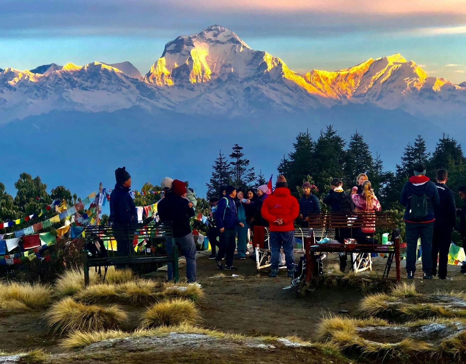
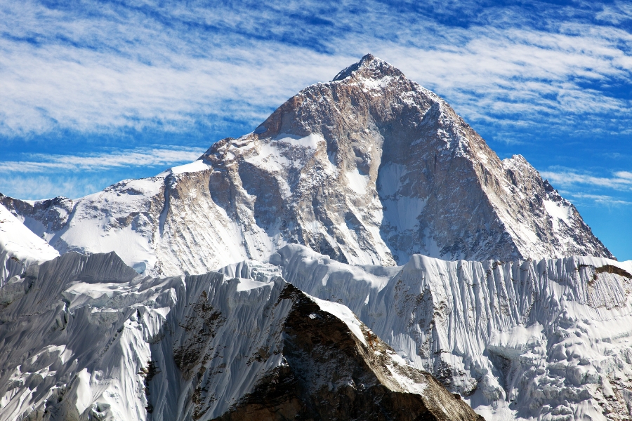
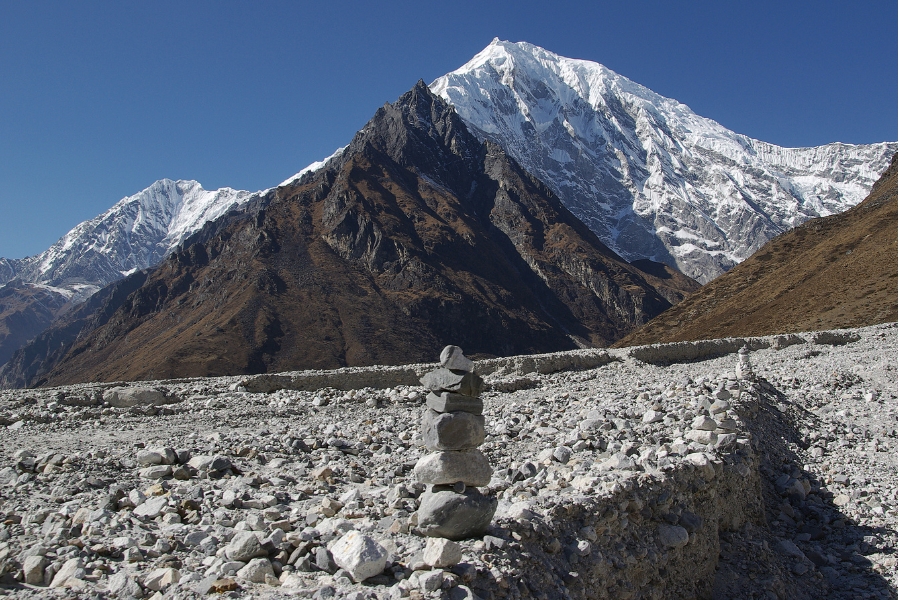
Rising into the subalpine and alpine zone of the country’s geography, the mountain region consists of about 90 peaks that exceed 7,000 meters and eight that exceed 8,000 meters- including Mount Everest at 8,848 meters and Kanchenjunga at 8,598 meters. Occupying only about 9% of Nepal’s total land, the mountain region is the home of many medicinal herbs and the beautiful rhododendron flowers- the national flower of Nepal. Famous for trekking- the Mountains of Nepal are beautiful, ethereal and majestic. The snowy peaks are famous for base camp journeys and the trails of the trekking journeys take travelers from ethnic villages to the gorgeous base camp of cerulean peaks. Here are some famous Mountains of Nepal-
Mount Everest
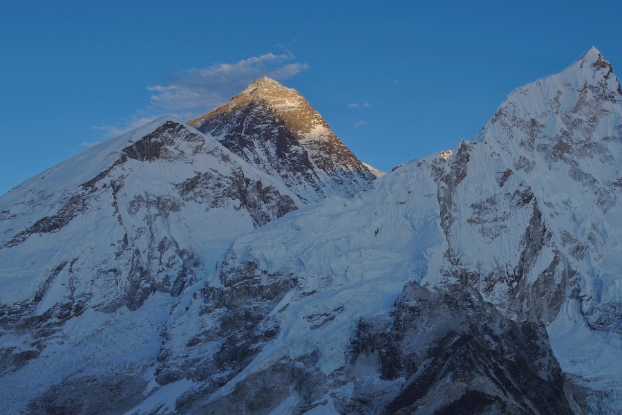
The world’s tallest Mountain Peak, Mount Everest is the epitome of grace and beauty. Called Sagarmatha in Nepal and Chomolungma in Tibet and China, Mount Everest is a part of the Mahalangur range. The international border between China and Nepal runs across Everest's summit point. Mount Lhotse, Nuptse and Changtse are the nearby peaks of Mount Everest.
First climbed in 1953 by Sir Edmund Hillary and Tenzing Norgay Sherpa, Mount Everest since then has become a famous destination in Nepal for trekking journeys, with thousands of trekkers doing treks in the Everest region every year. Named after Sir Gorge Everest, the mountain peak has two main climbing routes, one approaching the summit from the southeast in Nepal (known as the "standard route") and the other from the north in Tibet. Over 60 million years old, Mount Everest comprises different types of shale, limestone and marble covered heavily by a thick blanket of snow.
The peak of Mount Everest extends into the upper troposphere and penetrates the stratosphere; exposing it to the fast and freezing winds of the jet stream. Temperatures reach -80°F in the mountain and in mid-May each year, the jet streams move north, causing the winds to calm and the temperatures to warm, making it suitable for climbing the peak. “Chomolungma” translates to “the Mother Goddess of the world” and Sagarmatha means the “Head of the Sky”.
The Everest Base Camp Trek is a famous trekking journey that people from all over the world come to visit Nepal to do. The youngest person to summit Mount Everest was American Jordan Romero, age 13 in 2010. Japanese Miura Yiuchiro, age 80, was the oldest. She climbed Mount Everest in the year 2013. There are 18 different climbing routes on Everest. With 66% less oxygen in each breath at Mount Everest, altitude sickness is a common ailment that befalls trekkers. The Base Camp journey to Everest is filled with many Himalayan villages, the most famous ones being Namche Bazaar and Tengboche among many. Kalapatthar is a famous vantage point in the region that presents amazing panoramic views of the Mount Everest massif.
Despite initial attention received by Mount Everest after its first summiting, only about 200 people had climbed the peak by 1987. Everest remained a difficult climb for decades, even for serious attempts by professional climbers and large national expeditions, which were the norm until the commercial era began in the 1990s. When commercialization of trekking journeys took wind, base camp trekking to Mount Everest quickly grew in popularity and has now become one of the most famous trekking journeys on the planet.
Kanchenjunga
The third highest mountain in the world, Kanchenjunga is a beautiful mountain that lies partly in Nepal and partly in Sikkim, India. It lies 125 km southeast of Mount Everest. Kanchenjunga Mountain is named after the Five Treasures of the Snow, a treasure corresponding with each of its five peaks. Kanchenjunga Main is the highest mountain in India and is worshipped by the people of Sikkim and Nepal.
Kanchenjunga was first climbed on 25 May 1955 by Joe Brown and George Band, who were part of a British expedition. The origin of Kanchenjunga’s nomenclature comes from Tibet. The Tibetan meaning translates to “five repositories of a great snow”. According to local Lhopo people- the five treasures of the mountain are hidden and will reveal themselves only to a devout when the world is in peril. The treasures comprise salt, gold, turquoise and precious stones, sacred scriptures, invincible armor and ammunition, grain, and medicines. Believed by the Limbu people to be the abode of the omnipotent goddess Yuma Sammang, Mount Kanchenjunga also lies under the Kanchenjunga Conservation Area. The landscape of the mountain is comprised of three distinct eco-regions and 14 protected areas.
Kanchenjunga Base Camp Trek is a journey that travelers go through. The main ridge of the Kanchenjunga massif runs from north-north-east to south-south-west and forms a watershed to several rivers. Four main glaciers also radiate from the main peak. One of six peaks located in the basin of the Koshi River which is among the largest tributaries of the Ganges, the Kanchenjunga massif also forms part of the Ganges Basin. There are four climbing routes to reach the summit of Kanchenjunga, three of which are in Nepal from the southwest, northwest, and northeast, and one from northeastern Sikkim in India. The Antu Dada of Ilam in Nepal is famous for its gorgeous views of the mountain. On a clear day, it presents an image not so much of a mountain but of a white wall hanging from the sky.
Due to its remote location in Nepal and the difficulty involved in accessing it from India, the Kanchenjunga region is not much explored by trekkers. It has, therefore, retained much of its pristine beauty. According to local myth, the area around Kanchenjunga is said to be home to a mountain deity, called Dzö-nga or "Kanchenjunga Demon", a type of yeti or rakshasa. For generations, there have also been legends recounted by the inhabitants of the areas surrounding Mount Kanchenjunga, both in Sikkim and Nepal, that there is a valley of immortality hidden on the slopes of the Mountain. Raymond Benson, the author of the James Bond books, has also penned down a James Bond adventure in the Kanchenjunga Mountain in High Time to Kill.
Annapurna Mountain

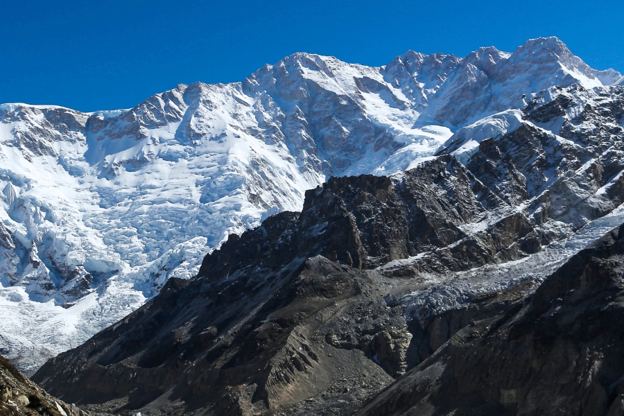
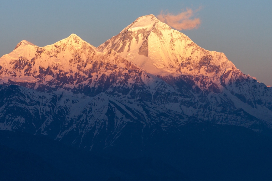
A Mountain massif in north-central Nepal, Annapurna includes one peak over 8,000 meters, thirteen peaks over 7,000 meters, and sixteen more over 6,000 meters. The massif is 55 kilometers long, and is bounded by the Kali Gandaki Gorge on the west, the Marshyangdi River on the north and east, and Pokhara Valley on the south. Enclosing a high basin called the Annapurna Sanctuary at its western end; Annapurna I Main is the tenth-highest mountain in the world.
Entirely protected by the Annapurna Conservation Area- the first and largest conservation area of Nepal, the Annapurna Mountain massif serves many world-class trekking journeys, including the famous Annapurna Circuit Trek. Annapurna gets its name from Sanskrit, where the name translates to “Full of Food”. The Annapurna Mountains are also considered the home of the Goddess of the Harvest. Annapurna is also associated with Lakshmi- the Goddess of wealth. Six of the prominent peaks of Annapurna over 7,200 meters include Annapurna I to IV, Annapurna South, and Gangapurna. Less prominent peaks in the Annapurna Himal include Annapurna I Central, Annapurna I East, Fang, Lachenal, Nilgiri Himal, Machhapuchhre, and Hiunchuli.
On 8th and 9th October 2013, one of the world’s most formidable alpinists- Swiss climber Ueli Steck, soloed the Lafaille route on the main and highest part of the Annapurna I face; this was his third attempt on the route and has been called "one of the most impressive Himalayan climbs in history", with Steck taking 28 hours to make the trip from Base Camp to summit and back again. Unfortunately, Ueli Steck lost his life on April 30th, 2017, while climbing in Nepal. Mount Machhapuchhre, named after its resemblance to a fish-tail, is another important peak and ranks the same in terms of popularity, though it just misses the 7,000-meter mark. Mount Machhapuchhre and Hiunchuli are prominently visible from the valley of Pokhara- an important starting point of many Annapurna Base Camp Treks. These peaks are the "gates" to the Annapurna Sanctuary leading to the south face of Annapurna I.
About two-thirds of all trekkers in Nepal tend to visit the Annapurna region. Due to the area’s easy accessibility, plentiful guest houses in the hills, and treks that offer incredibly diverse scenery, with both high mountains and lowland villages- the Annapurna region trekking is famous and right behind the Everest region trek. Also, because the entire area is inhabited, trekking in the region offers unique cultural exposure and experience.
Mount Makalu
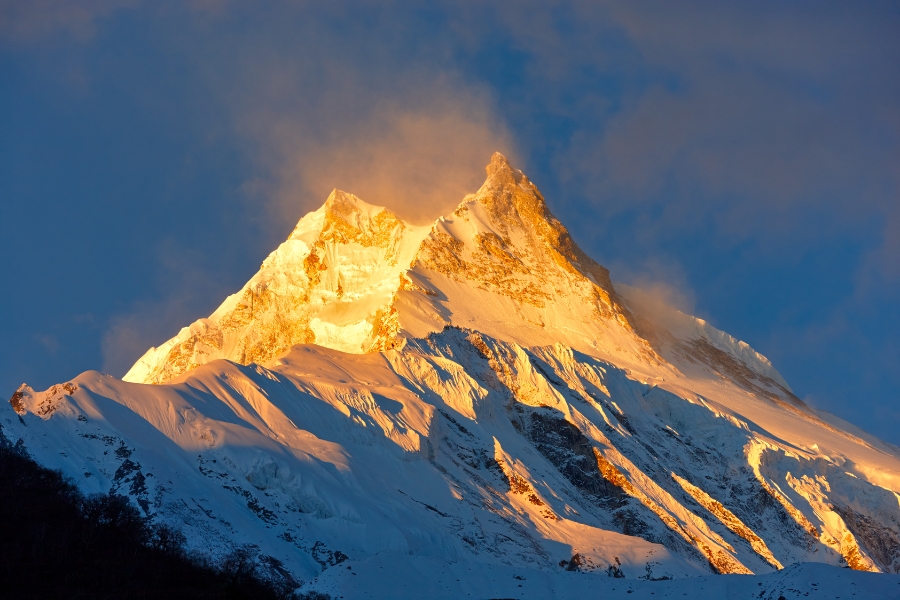
The fifth highest mountain in the world, Mount Makalu is a part of the Mahalangur Himalayas that lies southeast of Mount Everest on the border between Nepal and China. An isolated peak, Makalu’s shape is a four-sided pyramid. Kangchungtse and Chomo Lonzo, the two notable subsidiary peaks of Mount Makalu also add an ethereal feel to the peak.
Makalu was first summited on May 15, 1955, by Lionel Terray and Jean Couzy of a French expedition. Makalu is one of the harder eight-thousanders and is considered one of the most difficult mountains in the world to climb. The mountain is notorious for its steep pitches and knife-edged ridges that are completely open to the elements. The final ascent of the summit pyramid also involves technical rock/ice climbing. The notable feature of visiting Mount Makalu is the beautiful Makalu-Barun Valley. A Himalayan glacier valley situated at the base of Makalu in the Sankhuwasabha district of Nepal, the Makalu Barun Valley lies entirely inside the Makalu Barun National Park.
Brimming with stunning contrasts, where high waterfalls cascade into deep gorges, craggy rocks rise from lush green forests, and colorful flowers bloom beneath white snow peaks, the valley has a unique landscape that shelters some of the last pristine mountain ecosystems on Earth. Relatively undisturbed by humankind, rare species of animals and plants flourish in diverse climates and habitats. With its name derived from the Sanskrit word “Maha Kala”, Makalu is the name of the Hindu God Shiva which translates to “the Big Black” in literal English. Due to its isolation, Mount Makalu receives few trekkers- making it an off-the-beaten-paths destination. With Gurung, Rai, and Sherpa people inhabiting the region, the Makalu Base Camp Trek is a journey that is culturally rich and provides unique biological and traditional treasures of the Makalu Barun area. Barun Valley is also a sanctuary for animals like wolves, lynxes, foxes, and beautiful snow leopards.
Dhaulagiri
The massif of Dhaulagiri extends from the Kali Gandaki River to Bheri. Bounded on the north and southwest by tributaries of the Bheri River, Mount Dhaulagiri massif is a famous mountain range in the Annapurna region. Dhaulagiri I is the seventh-highest mountain in the world. The name of the mountain comes from two combinations of Sanskrit words- “Dhwala” meaning “dazzling, white, and beautiful” and “Giri” meaning “mountain”. Dhaulagiri I is also the highest point of the Gandaki River basin. Annapurna I lies 35 km east of Dhaulagiri I, creating the world’s deepest gorge- the Kali Gandaki Gorge, between these two mountains. The Kali Gandaki River flows through the gorge. The sudden rise of Dhaulagiri I from the lower ridges of the terrain is spectacular.
With few trekkers visiting the area, Dhaulagiri Circuit Trek is an off-the-beaten-paths trekking journey of the region. The Dhaulagiri massif includes the mountains of Dhaulagiri III, IV, and V, the main Churen Himal, east Churen Himal, west Churen Himal, Dhaulagiri VI and VII, Gurja Himal, the False Junction Peak, Peak Hawley, and the Hiunchuli Patan. On clear weather, the peak of Dhaulagiri I is also conspicuous from northern Bihar in India.
Its rise from the Kali Gandaki River is quite notably impressive, along with the south face of the Gurja Himal in the same massif. Its location is also responsible for creating rain-shadow zones in the areas adjacent to the mountain like Mustang and Dolpo. The blockade of rain clouds by the Dhaulagiri massif creates dry environments in Mustang that result in corroded hills and a badland-like environment. Mount Dhaulagiri is also a very popular Mountain range in the Annapurna, and its sight from the Lake-side city of Pokhara is also a grand affair.
Mount Manaslu
The eighth-highest mountain in the world- Mount Manaslu is a part of the Mansiri Himal massif of Nepal. Manaslu is also sometimes referred to as “Kutang” in Tibet. The name of the mountain translates to “the Mountain of Spirit” and because of its serenity, the name is quite befitting. Manaslu Mountain gives off a very tranquil vibe and its tincture of soft canary yellow as the sun’s rays reflect off the snow contributes to the mountain’s velvet-like dulcet. The word “Manaslu” comes from the Sanskrit word “manasa” meaning “intellect” or “soul”.
First climbed by Toshio Imanishi and Gyalzen Norbu in 1956, Mount Manaslu is famous for being a mountain for the Japanese people. Because both the first climbers of Mount Manaslu were members of a Japanese Expedition, Mount Manaslu is often an adage saying “Just as the British consider Everest their mountain, Manaslu has always been a Japanese mountain”. Manaslu is the highest peak in the Gorkha District and is located about 64 kilometers east of Annapurna. The mountain's long ridges and valley glaciers offer feasible approaches from all directions and culminate in a peak that towers steeply above its surrounding landscape. This is also a dominant feature of Mount Manaslu when viewed from afar.
The Manaslu Circuit Trek is a famous trekking journey taken in the Manaslu region by trekkers from all over. The trekking journey skirts the Manaslu massif over the pass down to Annapurna. Trekking in the Manaslu region has only been permitted by the Nepalese Government since 1991. Mount Manaslu is located along an ancient salt-trading route along the Burhi Gandaki River and trekking the circuit also presents views of about 10 peaks over 6,000 meters, including a few over 7,000 meters. The Manaslu Conservation Area has also been established with the primary objective of achieving conservation and sustainable management of the delimited area, which includes Manaslu.
Mount Manaslu is also famously serrated "a wall of snow and ice hanging in the sky". The three sides of the mountain fall in steps to terraces down below, which are sparsely inhabited with agricultural operations practiced on the land. Manaslu Himal, as it is popularly known among trekkers, provides views of the snow-covered mountains of the Himalayas and allows close interaction with the different ethnic groups who live in hill villages scattered along the trek route. Trekking to Manaslu is also a test of endurance for trekkers because of the mountainous terrain prone to the consequences of monsoon rainfall, landslides, and landfalls. Manaslu is known in the Tibetan language as "Kutang l", in which "tang" translates to the Tibetan word for a flat place. Important peaks surrounding Manaslu include Ngadi Chuli, Himalchuli, and Baudha. A glacial saddle known as the Larkya La, with an elevation of 5,106 meters, also lies north of Manaslu.
Machhapuchhre Mountain
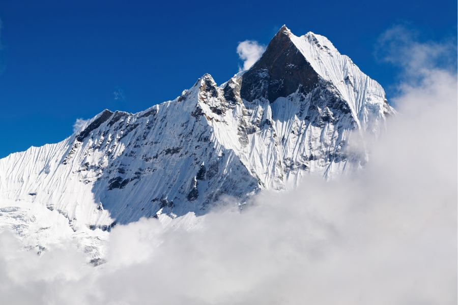
A famous mountain in the Annapurna Himalayas in the north-central of Nepal, Machhapuchhre Mountain is most famously referred to as “the FishTail Mountain” because of its peak resembling the tail of a fish. The Mountain is also revered by the local people as a particularly sacred abode of Lord Shiva, and because of its religious positioning, it is off-limits to climbing. It is also one of the most beautiful Mountains of Nepal to look at.
Machhapuchhre is at the end of a long spur ridge, coming south out of the main backbone of the Annapurna Himalayas, which forms the eastern boundary of the Annapurna Sanctuary. The peak is about 25 kilometers north of Pokhara and forms a beautiful reflection of the surface of the sapphire Fewa Lake. Due to its southern position in the range and the particularly low terrain that lies south of the Annapurna Himalayas, Machhapuchhre commands tremendous vertical relief in a short horizontal distance. This, combined with its steep, pointed profile, makes it a particularly striking peak, despite a lower elevation than some of its neighbors.
Machhapuchhre is also nicknamed the "Matterhorn of Nepal". A mountain that has never been climbed to its summit, Machhapuchhre’s only climbing attempt was in 1957 by a British team led by Lieutenant Colonel Jimmy Roberts. The sight of Machhapuchhre from Pokhara is a beautiful feature the city offers and many people visit the lake-side city because of its beautiful characteristic of being a popular adventure hub of the country.
Langtang Lirung
The highest peak of the Langtang Himal range, the Langtang Lirung lies on the southwest of the Shishapangma Peak. The Langtang Himal range forms the western portion of a complex of mountains which also includes the Jugal Himal. This complex lies between the Sun Koshi Valley on the east and the Trishuli Gandaki Valley on the west. Langtang Lirung lies near the Trishuli Gandaki, and north of the Langtang Khola. Though not high by the standards of major Himalayan peaks, Langtang Lirung is notable for its large vertical relief above the local terrain. With a large south face, the Langtang Lirung ranks at number 99 on the list of the World’s highest mountains. It is a notable feature of the Langtang Valley- a famous trekking destination in Nepal. Known as the Valley of Glaciers- Langtang is perhaps one of the most beautiful regions in the country.
The Langtang Lirung also made the news in 2009 when on November 9, the famous Slovenian mountaineer Tomaž Humar, who was on a solo climb via the South Face of the mountain, had an accident during his descent. He had completed over 1500 ascents and had won several mountaineering and other awards, including the Piolet d'Or in 1996 for his Ama Dablam ascent.
He became widely recognized in 1999 after his famous solo ascent of the south face of Dhaulagiri considered one of the deadliest routes in the Himalayas with a 40% fatality rate. It was reported that when an accident struck Humar during his ascent- he was stuck on the mountain at an elevation of approximately 6,300 meters for several days with a broken leg. His only contact with the base camp staff via a satellite phone was made on the day of the accident. Unfortunately, the famous Slovenian mountaineer Tomaž Humar did not survive. The rescue party found his body on November 14, 2009, at an elevation of 5,600 meters.
Lhotse
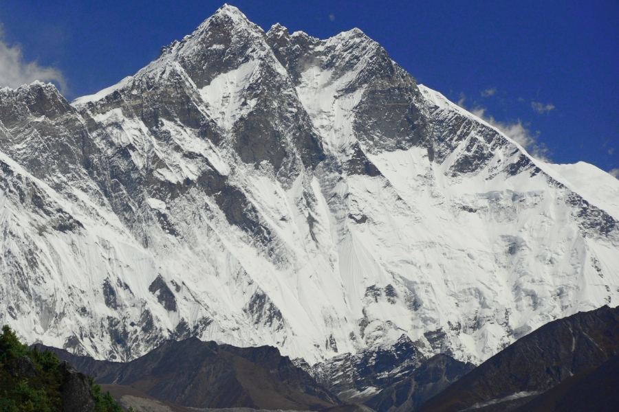
The fourth highest mountain in the world, Lhotse is a part of the Everest Mountain massif. Its Tibetan translation means “the South Peak”. The Lhotse peak comprises three- the main summit is 8,516 meters, the Lhotse middle (East) at 8,414 meters, and the Lhotse Shar at 8,383 meters. Lhotse lies on the border between Tibet and the Khumbu region of Nepal. The view of Lhotse while doing the famous Everest Base Camp Trek is quite prominent.
The main summit of Lhotse was first climbed in 1956 by the Swiss team of Ernst Reiss and Fritz Luchsinger from the Swiss Mount Everest/Lhotse Expedition. In 1970, Sepp Mayerl and Rolf Walter of Austria made the first ascent of Lhotse Shar. Lhotse Middle however, remained a long time, the highest unclimbed point on Earth, until in 2001- its first ascent was made by Eugeny Vinogradsky, Sergei Timofeev, Alexei Bolotov, and Petr Kuznetsov of a Russian expedition.
Furthermore, the western flank of the mountain, also known as the Lhotse Face, has to be climbed by any climbers bound for the South Col on Everest. The Lhotse Face is often described as a wall of glacial blue Ice. A glacier also originates from the Lhotse Shar and adjoins the Imja Glacier to its northeast. The panoramic view of the entire Everest massif, including Lhotse, can be seen from the famous vantage point of the Everest region- Kalapatthar.
Ama Dablam
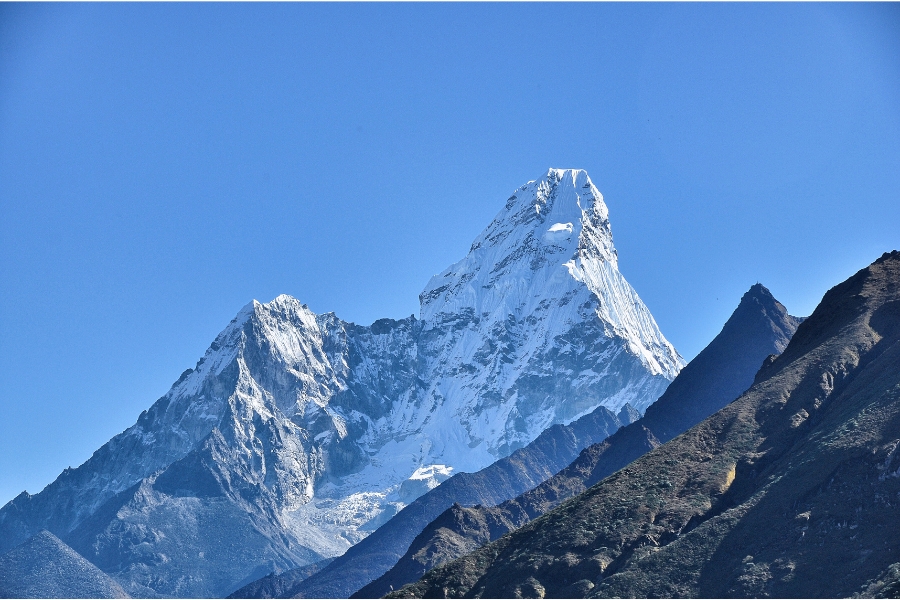
Ama Dablam is a famous Himalaya in eastern Nepal. Its view makes a spectacular appearance along Lhotse in Khumbu while trekking. For several days, Ama Dablam dominates the eastern sky for anyone trekking to the Mount Everest base camp. The word “Ama Dablam” means “Mother’s Necklace” in the Sherpa language and is quite befitting of the peak. Because of the peak’s long ridges on each side, it resembles the arms of a mother (Ama) protecting her child. The hanging glacier on the peak also resembles a Dablam- the traditional double-pendant containing pictures of gods worn by Sherpa women. The whole peak is believed to be a petrified goddess, much like the Hawaiian goddess Te Fiti from the Disney movie Moana.
Ama Dablam is the third most popular Himalayan peak for permitted expeditions. A climbing permit and a liaison officer are required when attempting Ama Dablam. As with Mount Everest, the best climbing months are April–May (before the monsoon) and September–October. The image of the Ama Dablam Peak is present on the label of the Aqua Mineral drinking water bottle. As opposed to Machhapuchhre which is called “the Matterhorn of Nepal”, Ama Dablam is called “the Matterhorn of the Himalayas”. Ama Dablam was also climbed in the September of 1997 by Bear Grylls, a world-famous British adventurer and television presenter.
Nepal has many more mountains that are beautiful and offer an opulent trekking journey. The mountains of Nepal are the country’s major source of revenue generation and the source of many people’s livelihoods. The Mountains of Nepal are also the sources of ever-flowing rivers and cerulean glaciers that feed the agricultural farms of the lowlands. Perseverance and preservation of the mountains of Nepal are a priority and their proper conservation is a must as too a large portion of the country’s tourism economy and the livelihood of the region’s people depend on them.