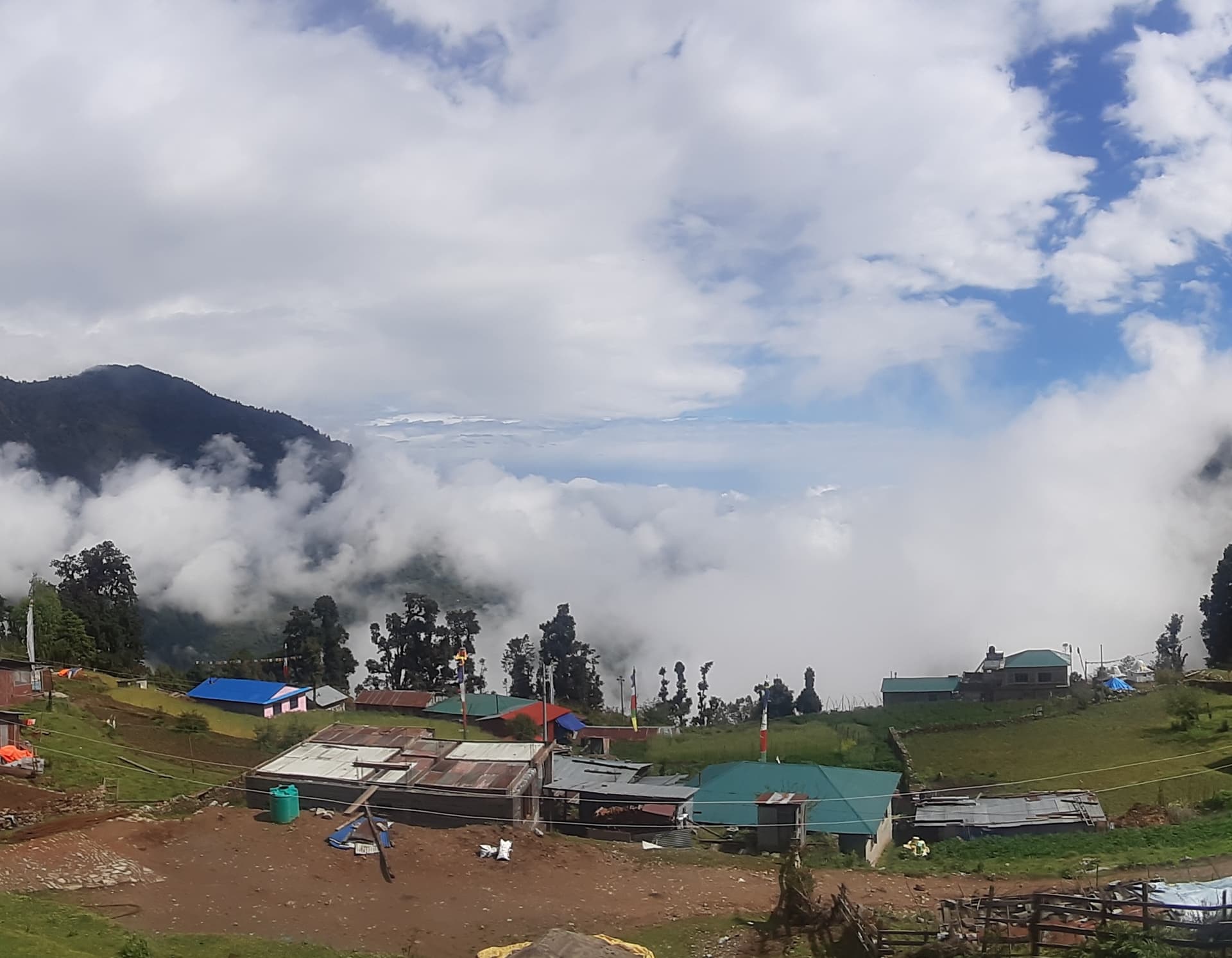
Best Season for the Tamang Heritage Trail: Month-by-Month Breakdown
The Tamang Heritage Trail's relatively low maximum altitude means that the seasonal considerations here are different from those on the Langtang Valley Trek or any high-altitude Himalayan route. The key variables are mountain views from Nagthali, forest conditions for wildlife and walking comfort, and trail quality rather than snowfall blocking passes or extreme cold at high camp.
Spring from March to May is the most popular window. The rhododendron and oak forest between Syabrubesi and the upper villages is in bloom from late February through April, and April specifically delivers the densest flowering. The mountain views from Nagthali Hill are clear on most spring mornings before afternoon cloud builds. The trail itself is in good condition and the teahouses are well-stocked. Book guides and accommodation at least 4 to 6 weeks in advance for spring departures.
Autumn from September to November is the other prime window. The air after monsoon is clear and the mountain panorama from Nagthali, covering Ganesh Himal, Langtang Lirung, and the Gosainkunda Range, is at its sharpest in October. Trails are dry and firm after the monsoon season. November brings slightly colder nights in the higher villages but the daytime walking conditions are excellent.
Winter from December to January is genuinely viable on this trail in a way that it is not on higher-altitude routes. The maximum overnight altitude of 2,650 meters means cold nights are manageable with proper layering, which the Escape Himalaya package covers with a minus 20-degree down jacket and sleeping bag. Light snowfall is possible above 2,500 meters in January, but the trail remains walkable and the mountain views from Nagthali on clear winter mornings are exceptionally sharp. Fewer trekkers means a quieter, more intimate experience in the villages.
Monsoon from June to August is not recommended. Leeches appear in the forest sections between Syabrubesi and Gatlang, trails become slippery on the steeper sections, and persistent cloud at Nagthali obscures the mountain views that are one of the trail's major highlights.
Tamang Heritage Trail Difficulty Level: Who This Trek Is Built For
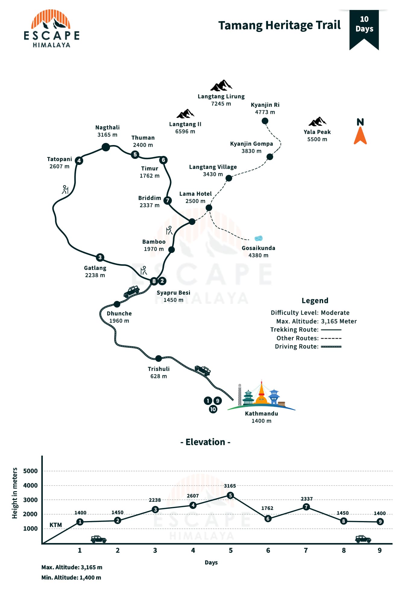
The Tamang Heritage Trail is graded moderate, and on this route that grade is genuinely accurate rather than a marketing understatement. The maximum altitude on the entire route is 3,165 meters at Nagthali Hill, reached as a day hike on Day 5 rather than an overnight stop. The highest overnight point is approximately 2,650 meters, well below the threshold where altitude sickness becomes a realistic concern for most healthy adults.
Daily walking runs between 12 and 16 kilometers over 5 to 6 hours on well-defined paths. The trails are clear throughout, with no navigation challenges, no technical sections, and no river crossings requiring special equipment. The Nagthali Hill day hike on Day 5 is the steepest stretch of the entire route and takes about 3 to 4 hours of uphill walking before the descent to Thuman.
This trek is specifically suited to:
- First-time Nepal trekkers who want a genuine cultural experience without altitude risk
- Families with older children who can handle 5 to 6 hours of walking per day
- Older trekkers for whom altitude above 3,500 meters is a concern
- Trekkers who have already done a high-altitude Nepal route and want something culturally richer
- Anyone who wants to spend time in genuine mountain communities rather than moving through them
- quickly on the way to a summit view
- Physical preparation of daily walks for 4 to 6 weeks before departure, with some stair climbing added for the Nagthali section, is sufficient for most trekkers.
Tamang Heritage Trail Permits: What You Need in 2026
The Tamang Heritage Trail falls within Langtang National Park, which requires one entry permit: the Langtang National Park Entry Permit at NPR 3,000 per person for foreign trekkers. This is checked at the Syabrubesi entry checkpoint before the trail begins.
As of 2025 and 2026, foreign trekkers in the Langtang region are required to trek with a licensed guide. Independent solo trekking is no longer permitted. Escape Himalaya includes a government-licensed, English-speaking guide in every Tamang Heritage Trail package as standard, so this requirement is already covered from the moment a booking is confirmed. Both the national park permit and the guide registration are managed by the Escape Himalaya team before arrival, with no additional permit coordination needed from the trekker.
Unlike the Manaslu Circuit or Upper Mustang, the Tamang Heritage Trail does not require a Restricted Area Permit. There is no TIMS card required for agency-booked trekkers. The permit logistics on this route are straightforward, which is one of the practical advantages of choosing it over more administratively complex restricted zone treks.
Tamang Culture Along the Trail: What to Know Before You Walk Through
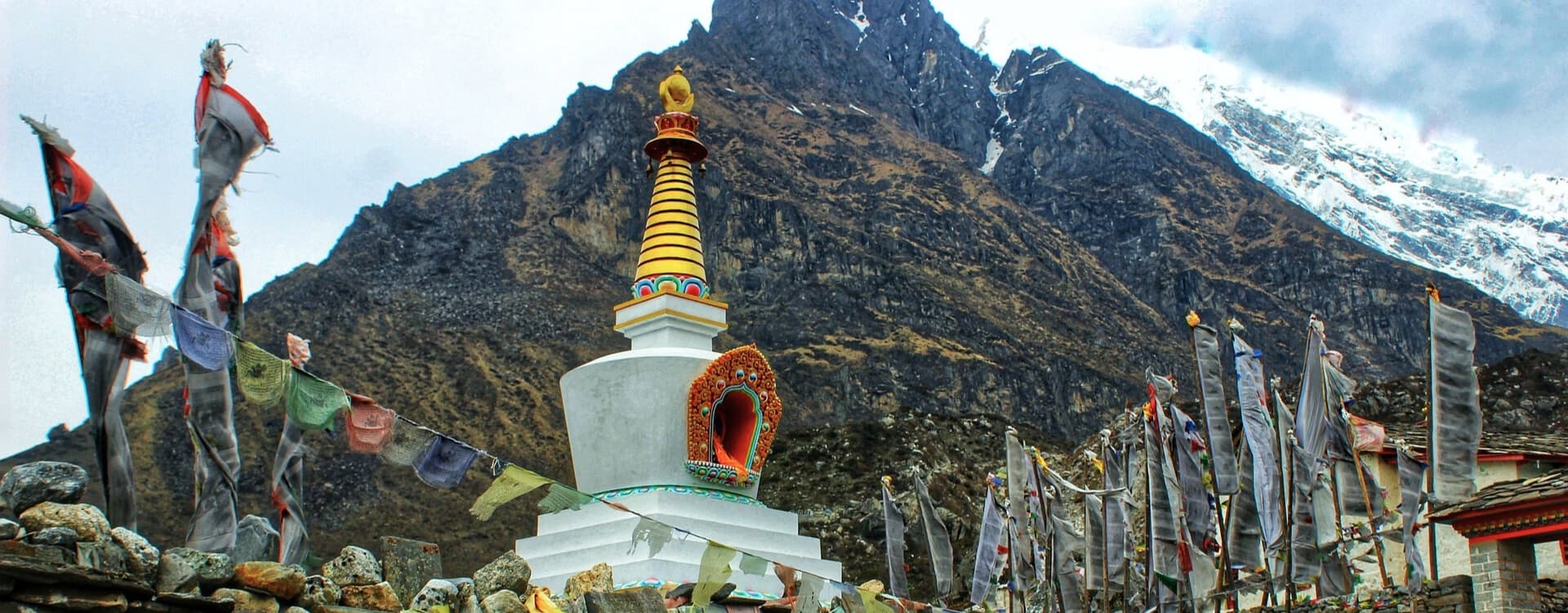
The Tamang people have a cultural identity that is distinct from the rest of Nepal in ways that go beyond dress and food. Their language, Tamang, is Tibeto-Burman and bears no relation to Nepali. Their religious practice draws from Tibetan Buddhism intertwined with Bon shamanic traditions, meaning the spiritual landscape along this trail reflects two ancient systems rather than one.
The physical markers of Tamang Buddhist practice appear throughout the villages:
- Mani walls: long stone structures carved with Buddhist mantras. The correct practice is to walk to the left of them.
- Prayer wheels: spin clockwise. This gesture of respect is explained by the guide on the first day.
- Chortens: dome-shaped stone structures at village entrances and junctions, each with specific religious significance.
- Khada: ceremonial white scarves offered as a welcome gesture. Accept with both hands.
The architecture in Gatlang, Thuman, and Briddim follows a signature Tamang style: round or rectangular stone construction with flat roofs, very different from the pitched roofs more common in Nepal's middle hills. The flat roofs are used for drying grain and storing fodder, reflecting the agricultural economy that underlies village life.
Tamang Lhosar, the Tamang New Year, falls in February and is one of the most significant celebrations in the communities along this trail. If timing allows, building a February departure around this festival adds a dimension to the cultural experience that no amount of monastery visits can replicate. The Damphu drum, a small tambourine-like instrument central to Tamang music, is played throughout the celebration.
Accommodation on the Tamang Heritage Trail
Accommodation on the Tamang Heritage Trail sits in a different register from the teahouse infrastructure on Everest or Annapurna routes. The trail was built to direct revenue to local communities, and the lodges reflect that intention. They are family-run, simple, and genuine in a way that the more commercial teahouse networks on higher-profile routes are not.
In Kathmandu, both the pre-trek and post-trek nights are at the Woodapple Hotel and Spa, a 3-star property in Thamel with private bathrooms, hot water, Wi-Fi, and breakfast included. The hotel also offers secure luggage storage for non-trekking items during the trail days, so trekkers carry only what they need.
On the trail itself, accommodation is basic twin-sharing rooms in guesthouses or family-run lodges throughout. Shared bathrooms are standard at all stops. Hot showers are available at most teahouses but charged separately, typically NPR 300 to 400 per person. They are not available at every stop, particularly in the more remote upper villages.
Wi-Fi is available at some teahouses in the lower villages at USD 2 to 3 per day. Connectivity drops significantly from Thuman onward. Downloading offline maps in Kathmandu before departure is strongly recommended.
Device charging is available at most stops for NPR 100 to 300 per device. The higher villages rely on solar power with limited evening electricity output. A fully charged power bank, topped up at every opportunity lower on the trail, is the most practical solution for the Briddim and Timure sections.
Cash, Connectivity, and Practical Details for the Trail
There are no ATMs anywhere on the Tamang Heritage Trail after Syabrubesi. All cash needed for personal expenses must be withdrawn in Kathmandu before the drive to Syabrubesi on Day 2.
Personal daily expense estimates for the 6 trekking days:
- Hot shower: NPR 150 to 200 per person where available
- Wi-Fi: USD 2 to 3 per day at lower villages
- Bottled water: NPR 100 to 200 at lower elevations
- Snacks and extras: USD 3 to 7 per day
- Total personal spend for the trekking section typically runs USD 80 to 130 per person. The Escape Himalaya package covers all meals (breakfast, lunch, and dinner) and accommodation throughout the trek, so personal expenses are genuinely limited to showers, connectivity, and extras.
NTC SIM cards perform better than Ncell throughout the Langtang region. Signal is reliable in Syabrubesi and Gatlang, patchy in Thuman and Timure, and weak in Briddim. If staying in contact matters throughout the trek, inform family and friends before departure that there will be periods with no reliable network.
Tipping is expected and genuinely appreciated. Standard guidelines: guide USD 6 to 8 per trekker per day, porter USD 4 to 6 per trekker per day. Tips are given at the end of the trek, either in Syabrubesi on the final trekking day or during the drive back to Kathmandu.
Tamang Heritage Trail vs Langtang Valley Trek: Choosing the Right Route
Both treks start and end at Syabrubesi. Both fall within Langtang National Park. Both run for 10 days in the Escape Himalaya portfolio. Beyond those similarities, they are genuinely different journeys built for different purposes.
The Langtang Valley Trek follows the Langtang River northeast from Syabrubesi through Lama Hotel, Langtang Village, and up to Kyanjin Gompa at 3,870 meters. The highest optional hike reaches Tsergo Ri at 4,984 meters. The focus is mountain scenery, the rebuilt Langtang Village post-earthquake, the Kyanjin Gompa monastery, the yak cheese factory, and the glacial landscape above the tree line.
The Tamang Heritage Trail heads west and north from Syabrubesi through communities at lower elevation with a maximum overnight altitude of around 2,650 meters. The focus is the Tamang people, their villages, monasteries, cultural practices, and the physical spaces they have built and maintained over centuries.
Who should choose the Tamang Heritage Trail:
- Trekkers who want cultural depth as the primary experience
- Beginners and those for whom altitude above 3,500 meters is a concern
- Anyone who has already done Langtang Valley and wants something different in the same region
- Trekkers with limited time who want a meaningful experience close to Kathmandu
Who should choose the Langtang Valley Trek:
- Trekkers who want mountain scenery, glacier walks, and high viewpoints
- Those comfortable at 3,870 meters and above
- Trekkers who want to combine high altitude with cultural elements at Kyanjin Gompa
For trekkers who want both experiences combined, the Langtang Gosainkunda Helambu Trek provides an extended journey covering both the valley and the broader Langtang region across 16 days.
Frequently Asked Questions: Tamang Heritage Trail
What is the Tamang Heritage Trail and who created it?
The Tamang Heritage Trail is a cultural trekking route through the Langtang region established by the Rural Poverty Alleviation Programme (RPAP) to direct trekking revenue directly into Tamang communities. It passes through Gatlang, Tatopani, Thuman, Timure, and Briddim, covering the cultural heartland of the Tamang people.
How many days is the Tamang Heritage Trail with Escape Himalaya?
The Escape Himalaya package runs 10 days, including the drive from Kathmandu to Syabrubesi on Day 2, six trekking days, the return drive on Day 9, and hotel nights in Kathmandu at the start and end. The minimum group size is 1 person.
What is the maximum altitude on the Tamang Heritage Trail?
The highest point reached is Nagthali Hill at 3,165 meters, covered as a day hike on Day 5. The highest overnight stop is approximately 2,650 meters. Altitude sickness is not a realistic concern on this route for most healthy adults.
Is the Tamang Heritage Trail suitable for beginners?
Yes. The maximum overnight altitude is well below the threshold where altitude sickness becomes likely, daily walking runs 5 to 6 hours on well-marked trails, and no technical skills are required. It is one of the most genuinely beginner-accessible cultural treks in Nepal.
What villages do you visit on the Tamang Heritage Trail?
The trail passes through Gatlang (2,238 m), Tatopani (2,607 m), Thuman (2,400 m), Timure (1,762 m), and Briddim (2,337 m), each reflecting a distinct aspect of Tamang cultural life from sacred lakes and hot springs to ancient trading routes and Tibetan-origin stone architecture.
What is special about Gatlang village?
Gatlang is considered the most culturally intact Tamang village on the trail. It has round stone houses with flat roofs, a sacred Tamang monastery, Parvati Kunda Lake used for religious rituals, and an evening Syabru dance performance specific to this community.
What are the Tatopani hot springs and are they included?
Tatopani translates as "hot water" in Nepali. The natural geothermal pools here have been used by the local Tamang community for generations. A soak in the hot springs is a standard part of the itinerary, not an optional extra, and is one of the more genuinely memorable stops on the trail.
What is Nagthali Hill and what can you see from the top?
Nagthali Hill at 3,165 meters is the highest point of the trek, reached as a day hike on Day 5. The view from the top covers Langtang Lirung, Langtang II, Ganesh Himal, Kerung (Tibet Peak), Sanjen, Paldor Peak, and the Gosainkunda Range in a panorama that rivals viewpoints on far more demanding trekking routes.
What is Briddim and why is it the cultural highlight of the trek?
Briddim at 2,337 meters is a Tamang village of Tibetan-origin inhabitants sitting at the foot of Langtang Himal. Stone houses, flat-roofed architecture, and the Dukchu Gomba monastery give it a character distinct from any other village on the trail, and it carries a genuine sense of remoteness despite being only a day's walk from the road.
What is the Dukchu Gomba monastery in Briddim?
Dukchu Gomba is an active Buddhist monastery in Briddim that visitors can explore. It is part of the Tibetan Buddhist tradition and reflects the deep religious heritage of the Tamang-Tibetan community living in the village.
What is the significance of Parvati Kunda Lake near Gatlang?
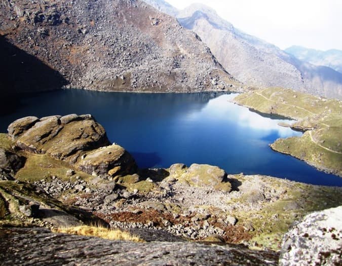
Parvati Kunda is a sacred glacial lake above Gatlang used for religious rituals by the local Tamang community. It is not a commonly listed tourist attraction but holds genuine spiritual importance for the people who live in the village below it.
What peaks are visible from the Tamang Heritage Trail?
From Nagthali Hill at 3,165 meters, the view covers Langtang Lirung, Langtang II, Ganesh Himal, Kerung (Tibet Peak), Sanjen, and Paldor Peak. The Gosainkunda Range is also visible. Views of Ganesh Himal are available on the trail approach from Gatlang to Tatopani as well.
What permits are required for the Tamang Heritage Trail in 2026?
One permit is required: the Langtang National Park Entry Permit at NPR 3,000 per person for foreign trekkers. No Restricted Area Permit is needed. Escape Himalaya arranges all permits before the trek begins.
Is a licensed guide mandatory for the Tamang Heritage Trail?
Yes. As of 2025 and 2026, foreign trekkers in the Langtang region are required to trek with a licensed guide. Independent trekking is no longer permitted. Escape Himalaya includes a government-licensed guide in every package.
How does the Tamang Heritage Trail compare to the Langtang Valley Trek?
The Langtang Valley Trek reaches 3,870 meters at Kyanjin Gompa and focuses on mountain scenery and glacial landscape. The Tamang Heritage Trail reaches a maximum overnight altitude of 2,650 meters and focuses on Tamang cultural villages. Both run 10 days from Syabrubesi. See the Langtang Valley Trek for comparison.
What is the best time of year to do the Tamang Heritage Trail?
Spring (March to May) for rhododendron bloom and warm conditions, and autumn (September to November) for the clearest mountain views from Nagthali. Winter (December to January) is also viable due to the low maximum altitude. Monsoon (June to August) is not recommended.
Can I do the Tamang Heritage Trail during winter?
Yes. The maximum overnight altitude of approximately 2,650 meters means winter cold is manageable with proper layers, which the Escape Himalaya package provides. Light snowfall is possible above 2,500 meters in January but the trail remains walkable. Nagthali views are exceptionally sharp on clear winter mornings.
What wildlife can I see on the Tamang Heritage Trail?
Red pandas in the bamboo and oak forest sections between Syabrubesi and the mid-altitude villages, Himalayan thar on the open ridges near Nagthali, musk deer in the forest sections, and langur monkeys in the tree lines near the lower trail. Over 250 bird species have been recorded within Langtang National Park.
Are hot showers available on the trail?
Hot showers are available at most teahouses but charged separately at approximately NPR 300 to 400 per person. They are not available at every stop, particularly in the more remote upper villages. Wet wipes are useful for the nights without shower access.
Is Wi-Fi available on the Tamang Heritage Trail?
Wi-Fi is available at some teahouses in the lower villages at USD 2 to 3 per day. Connectivity drops significantly from Thuman onward. Download offline maps in Kathmandu before departure.
What is Tamang Lhosar and can I experience it on this trek?
Tamang Lhosar is the Tamang New Year, celebrated in February with Damphu drum music, community dancing, and village gatherings. Building a February departure around this festival adds a cultural dimension to the trek that no other timing provides.
What does Tatopani mean and what are the hot springs like?
Tatopani means hot water in Nepali. The natural geothermal pools sit beside the river at the village of the same name. Three to four pools of varying temperature are available. The local community considers the water to have therapeutic properties and has used the springs for generations.
What is the Chilime Hydropower Dam and why does the trail pass it?
The Chilime Hydropower Dam is a run-of-river hydroelectric project built in the gorge between Gatlang and Tatopani. The trail passes close to it on Day 4. It is an unexpected industrial element on a cultural trekking route but reflects the Tamang region's role in Nepal's modern energy supply.
What is the Timure castle and what is its historical significance?
Timure was one of the oldest trading corridors between Nepal and Tibet, and the castle that still stands in the village reflects centuries of diplomatic and commercial history between the two regions. It is one of the more historically specific stops on the entire trail.
How much spending money do I need per day on the Tamang Heritage Trail?
Budget approximately USD 15 to 25 per day for personal expenses covering hot showers, Wi-Fi, bottled water, snacks, and extras. Total personal spend for the 6 trekking days typically runs USD 80 to 130 per person. Withdraw all cash in Kathmandu before departure.
Is the Tamang Heritage Trail good for solo female trekkers?
Yes. The trail passes through established Tamang villages with family-run guesthouses, a licensed guide is legally required and included in every Escape Himalaya package, and the route is well-traveled enough that the community along it regularly hosts international trekkers. Escape Himalaya regularly organizes departures for solo female travelers.
Can I combine the Tamang Heritage Trail with the Langtang Valley Trek?
Yes, with a customized itinerary. The two routes share Syabrubesi as their starting point, which makes a combined journey logistically straightforward. Contact the Escape Himalaya team to discuss a combined itinerary that covers both the cultural trail and the Kyanjin Gompa section of the valley.
What is Nagthali known for beyond mountain views?
Beyond the Himalayan panorama, Nagthali is also known as a viewpoint for the Gosainkunda Range and the Tibetan peaks across the border. The ridge walk approaching Nagthali passes through rhododendron forest and offers sightlines of Ganesh Himal and the Langtang range from multiple angles before reaching the highest viewpoint.
How fit do I need to be for the Tamang Heritage Trail?
Regular walking of 45 to 60 minutes daily for 4 to 6 weeks before departure is sufficient preparation for most trekkers. The longest day covers approximately 14 to 16 kilometers with the Nagthali Hill hike included. No technical fitness is required beyond the ability to walk uphill for several hours on a trail day.
What gear does Escape Himalaya provide for the Tamang Heritage Trail?
The package includes a 120-liter duffel bag carried by the porter, a down jacket rated to minus 20 degrees Celsius, a four-season sleeping bag of the same rating, a trekking map, an Escape Himalaya T-shirt, and a trek completion certificate. All gear is on loan for the trek duration and returned at the end. For a full packing list, see the Escape Himalaya Equipment Checklist.